Welcome to the webpage of FIG Working Group 5.2 -
Reference Frame in Practice !
Whats Hot ! (Latest News)
2009-05-28
ESA's
Gravity Mission GOCE
Launched on 17 March 2009, ESA's Gravity field and steady-state Ocean
Circulation Explorer (GOCE) was developed to bring about a whole new
level of understanding of one of Earth's most fundamental forces of
nature – the gravity field.
Full story at
http://www.esa.int/esaLP/ESAYEK1VMOC_LPgoce_0.html
2009-05-27
The Final Report from the US
Government Accountability Office (GAO) on GLOBAL POSITIONING SYSTEM:
Significant Challenges in Sustaining and Upgrading Widely Used
Capabilities has been released. The report
is available for download at
http://www.gao.gov/Products/GAO-09-325
2008-08-14
FIG Working Week was held in Stockholm in Sweden. As usual,
Commission 5 was very active with a number of sessions and papers. All
papers, posters and presentations are presented on the
FIG Website.
Commission 5 also organised a poster session on CORS Networks. These
posters, together with other descriptions on various CORS, can be found
under “Useful links – Reference Frame”
2007-11-15
FIG Regional Conference was held in San Jose in Costa Rica.
Commission 5 had several sessions that attracted much interest from the
conference delegates. Papers and presentations are presented on the
FIG Website.
Commission 5 produced a number of fact sheets and these can be found
under the section “Technical Manuals and Fact Sheets”
2007-08-27
LEICA GEOSYSTEMS ASSISTS WITH AFREF PROJECT
- See web location -
http://www.leica-geosystems.com/corporate/en/lgs_66547.htm
2007-08-27
Release of EPSG Geodetic Parameter Dataset v6.13
(July 16, 2007)
This release (Version 6.13) of the EPSG Geodetic Parameter
Dataset comprises of data corrections and updates to the v6.12 release
of February 2007. The EPSG Geodetic Parameter Dataset is maintained by
the Geodesy Subcommittee of the Surveying and Positioning Committee of
the International Association of Oil and Gas Producers (OGP). This
version and prior archived versions may be downloaded without charge
from www.epsg.org. The
dataset will continue to be known as the EPSG Geodetic Parameter
Dataset.
As for previous releases, the v6.13 dataset is available in two
forms: either an MS Access database which also includes a data reporting
capability, or as a series of SQL scripts for populating an alternative
relational database application. There are different SQL scripts for
various SQL variants. In each format, the v6.13 release is accompanied
by an updated version of the current ReadMe file, in both PDF and MS
Word formats.
New to Version 6.13 are:
- Changes as documented in Change table records through 2007.067,
but with actions still remaining on some change requests
- Revisions to data for Australia, Barbados, Belgium, Colombia,
Germany, Greenland, Fiji, Kuwait, Namibia, Netherlands, Reunion,
South Africa, Spain and United Kingdom.
- New data for Canada, China, France, Germany, Indonesia, New
Caledonia, New Zealand, South Georgia, United Arab Emirates and
United States.
- The use of the terms 'supersede', 'retire' and 'replace' has
been rationalised. This has included structural changes to the
Supersession table in which the supersession type of 'replacement'
has been eliminated. The rationalisation has also included changes
to the supersession type assigned to records within the supersession
table and to remarks in records in other tables. The EPSG dataset
interpretation of ISO 19135 terms is discussed in
Guidance Note 7
part 1 – Use of the EPSG Geodetic Parameter Dataset.
In addition to the above data content changes, the “Use of the
Data” rules have been clarified and expanded to facilitate increased
use of the EPSG dataset in third party software. See the Readme file or
associated online documentation for additional details.
2007-08-27
On July 26, 2007 the United States and European Union announce the
final design for GPS L1C and Galileo L1F signal. More info at:
http://useu.usmission.gov/Dossiers/Galileo_GPS/Jul2607_Civil_Signal_Accord.asp
2007-02-27
FIG and ION
Co-operation Agreement SIGNED !
The FIG Council held its first meeting in early March. One of the
agenda items was the Co-operation Agreement between the Institution of
Navigation (ION) and FIG. The agreement was adopted and signed by the
FIG Council and will now be presented at the General Assembly in Hong
Kong in May for their information.
Commission 5 and ION will investigate joint activities on topics such
as -
- Reference frames and observing systems
- Positioning, measurements and applications
- Navigation and tracking
- Geoid determination and height systems
- Sensors and platforms
- Hydrographic surveying, marine geodesy
- Systems for data processing, analysis and representation
- Special applications of geodesy to engineering
- Theory and algorithms
- Education and training
- Cooperation with other international organizations such as the
United Nations
- (UN) and International Organization for Standardization (ISO)
- Contributing to multi-disciplinary research and advisory teams
Currently the FIG liaison officer with ION is FIG VP Matt Higgins and
he will discuss with Rudolf Staiger who will be the Commission 5 contact
person in the future.
We look forward to good co-operation and the benefits to both ION and
FIG. More information on ION, please see www.ion.org.
2007-02-27
2007 is dedicated as the IHY 2007. IHY stands for International
Heliophysical Year. Heliophysical is a broadening of the concept
"geophysical," extending the connections from the Earth to the Sun and
interplanetary space. On the 50th anniversary of the International
Geophysical Year, the 2007 IHY activities will build on the success of
IGY 1957 by continuing its legacy of system-wide studies of the extended
heliophysical domain. To learn more about it, please check
www.ihy2007.org
2007-02-27
Information on the conclusions of the First Meeting of the
International Meeting on Global Navigation Satellite Systems organized
by the Office for Outer Space Affairs on 1-2 November 2006 in Vienna,
Austria can be found on the press release which can be read on the
following website:
http://www.unis.unvienna.org/unis/pressrels/2006/unisos343.html
2007-02-27
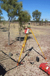
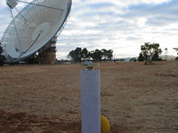
Australian Geodetic Community receive $15.8 million AUD to enhance
geodetic infrastructure. In summary this infrastructure will consist of
- Approximately 50 GNSS base stations distributed across the
Australian continent,
- A new VLBI site and replacements for the other ageing 2 systems,
- An upgrade to the SLR system, and
- The purchase of both an absolute (FG5) and relative gravity
meter.
Refer to the following web links for more information.
General Information:
http://www.ncris.dest.gov.au/
Australian Federal Minister's press release:
http://www.dest.gov.au/Ministers/Media/Bishop/2006/11/B001271106.asp
Fact Sheet on the AuScope part:
http://www.ncris.dest.gov.au/NR/rdonlyres/79D83DCE-8CA2-4E4B-99CC-F7B7A2B2CC4C/14718/NCRISfactsheets_oz_structure_content.pdf
See also:
http://www.auscope.org.au/
2006-11-06
ITRF 2005 is now released. You can find more information at
http://itrf.ensg.ign.fr/ITRF_solutions/2005/.
Mikael Lilje
2006-11-06
EPSG GEODETIC PARAMETER DATASET v 6.11.2
The EPSG geodetic parameter dataset is a repository of parameters
required to:
- identify coordinates such that those coordinates describe position
unambiguously. This is through a coordinate reference system (CRS)
definition.
- define transformations and conversions that allow coordinates to
be changed from one CRS to another CRS. Transformations and
conversions are collectively called coordinate operations.
Version 6.11.2 is the current release of the EPSG dataset,
distributed in an MS Access 97 database and/or as SQL scripts.
For more info, please see www.epsg.org
Technical Manuals and Fact Sheets
Need some facts ? Then click
here.
Useful Links
What else is out there ! Then click
here.
Highlight Papers
To peruse our library of reference frame highlight papers, click
here
!
Discussion Forum
Do you have a question about reference frames ? Then click
here !
About This Work Group
Need to know more about FIG Commission 5, Working Group on Reference
Frame ? Then click here and you will also find
contact addresses to the persons involved with this working group ! |