|
Progress reports
Progress reports from Asia-Pacific Capacity Development
Network at FIG General Assemblies:
News
AP CDN at the FIG Working Week 2025
April 2025
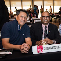
The network worked
collaboratively with FIG commissions, task forces,
and the Pacific Geospatial Survey Council (PGSC) to
organise 6 technical sessions and 2 Talanoa
meetings for the 3-day technical program in
Brisbane, Australia.
General
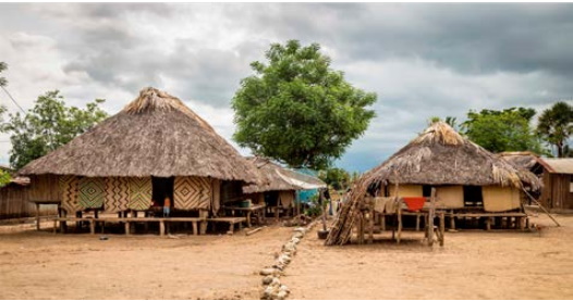
The origins of the FIG Asia Pacific Regional Network (FIG AP
CDN) emerged
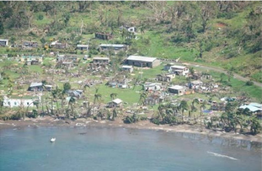
at the FIG Pacific Small Island Development Symposium (SIDS)
held in Lami Bay Suva, Fiji, September 2013. The network
officially formed in response to the Suva Statement on
“Spatially Responsible Governance”, and after the Christchurch, New Zealand Working Week in 2016.
Overtime the network has become known as the FIG Asia Pacific
Capacity Development Network (AP CDN). The network’s remit and
audience has varied and interchanged, as our attention to build
capacity and capability for geospatial reference systems has
also diversified into providing similar advice for surveying and
geospatial information management. As a consequence, the FIG AP
CDN membership has expanded and consists of participants from
our Commissions, the corporate sector, professional
associations, academic networks, our sister organisations, and
affiliated government agencies involved with geodesy, surveying,
mapping, and geospatial information management.
For this work plan, the main purpose of the FIG AP CDN is
provision of specialist advice and support to develop the
capabilities and capacities required to modernise geospatial
survey infrastructures (GSIs) in the Asia Pacific region, and
for countries to establish for fit for purpose GSIs that realise
responsible land governance, administration, management in
multiple environments.
To put the above into context:
- Geospatial Survey Infrastructure – comprises of people,
hardware, technology, software, work processes, standards
and practices, legal and policy frameworks, and the geodetic
reference frame (co-ordinate system or datum) underpinning
spatial data.
- Capacity development means - improving the foundations
of a geospatial survey organisation (GSO), such as
infrastructure, resources, and systems that enable the GSO
to achieve the business objectives. It also includes
understanding the impediments to development, establishing a
GSO culture and environment that facilitates the achievement
of sustainable development outcomes, and consists of
relevant policies, legal frameworks, as well as financial
and technical programs.
- Capability development means enhancing the necessary
skills, knowledge, and resources that enable individuals
within the GSO to undertake tasks and activities to achieve
business objectives, as well as personal goals. To ensure
the success of capability development, a program that
identifies the challenges, capabilities, as well as
strategies, plans and implementation pathways to build
specific capabilities is a necessity.
The activities of FIG AP CDN also are focused on:
- addressing the technical and administrative GSI challenges, and
- advocating how GSIs can influence the socio and economic
issues being faced today.
To deliver these remits, and to support GSI workshops,
seminars and meetings, FIG AP CDN will rely on the will to
succeed, significant collaboration and relationship building
with like-minded agencies and professional bodies, engendering
local leadership and action on GSI capacity and capability, and
the alignment or harmonisation of expectations, wants and needs
with the broader objectives of a country’s government.
|
|